
Welty, Oklahoma
Welty | |
|---|---|
 Welty Location within the state of Oklahoma  Welty Welty (the United States) | |
| Coordinates: 35°37′09″N 96°24′47″W / 35.61917°N 96.41306°W | |
| Country | United States |
| State | Oklahoma |
| County | Okfuskee |
| Area | |
| • Total | 2.39 sq mi (6.19 km2) |
| • Land | 2.37 sq mi (6.14 km2) |
| • Water | 0.02 sq mi (0.05 km2) |
| Elevation | 715 ft (218 m) |
| Population (2020) | |
| • Total | 131 |
| • Density | 55.27/sq mi (21.34/km2) |
| Time zone | UTC-6 (Central (CST)) |
| • Summer (DST) | UTC-5 (CDT) |
| FIPS code | 40-80000 |
| GNIS feature ID | 2805361[2] |
Welty is an unincorporated community in Okfuskee County, Oklahoma, United States.[2] Named for the town developer, Edwin A. Welty, its post office was established October 12, 1905, with Jerimiah D. Wilson as the first postmaster.[citation needed]
Welty is south of Bristow and north of Castle on the west side of Oklahoma State Highway 48 off E 960 Rd.[3]
Okemah Lake, southeast of town,[3] features swimming, boating, hunting, fishing, and camping.[4]
Demographics
| Census | Pop. | Note | %± |
|---|---|---|---|
| 2020 | 131 | — | |
| U.S. Decennial Census[5] | |||
References
- ^ "ArcGIS REST Services Directory". United States Census Bureau. Retrieved September 20, 2022.
- ^ a b c U.S. Geological Survey Geographic Names Information System: Welty, Oklahoma
- ^ a b "Welty, Oklahoma". Google Maps. Retrieved August 9, 2020.
- ^ "Okemah Lake". City of Okemah. Retrieved July 3, 2020.
- ^ "Census of Population and Housing". Census.gov. Retrieved June 4, 2016.
Municipalities and communities of Okfuskee County, Oklahoma, United States | ||
|---|---|---|
| City | 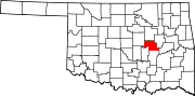 | |
| Towns | ||
| CDP | ||
| Other communities | ||
| Indian reservation | ||
| Footnotes | ‡This populated place also has portions in an adjacent county or counties | |
This Oklahoma state location article is a stub. You can help Wikipedia by expanding it. |